 Erebus Solar
Measure shade on site with the phone in your pocket.
Erebus Solar captures the sky above a roof or ground mount, draws the sun's year-round path over the real horizon, and turns it into a shade report and horizon files that HelioScope, PVsyst and PV*SOL read directly. No extra hardware, no cloud account, no waiting.
Built for the walk-around, not the office.
Everything happens on the phone, on the roof, in minutes.
Projects by address or GPS
One project per site, with status from Created to Completed, worst-case solar access and a thumbnail at a glance.
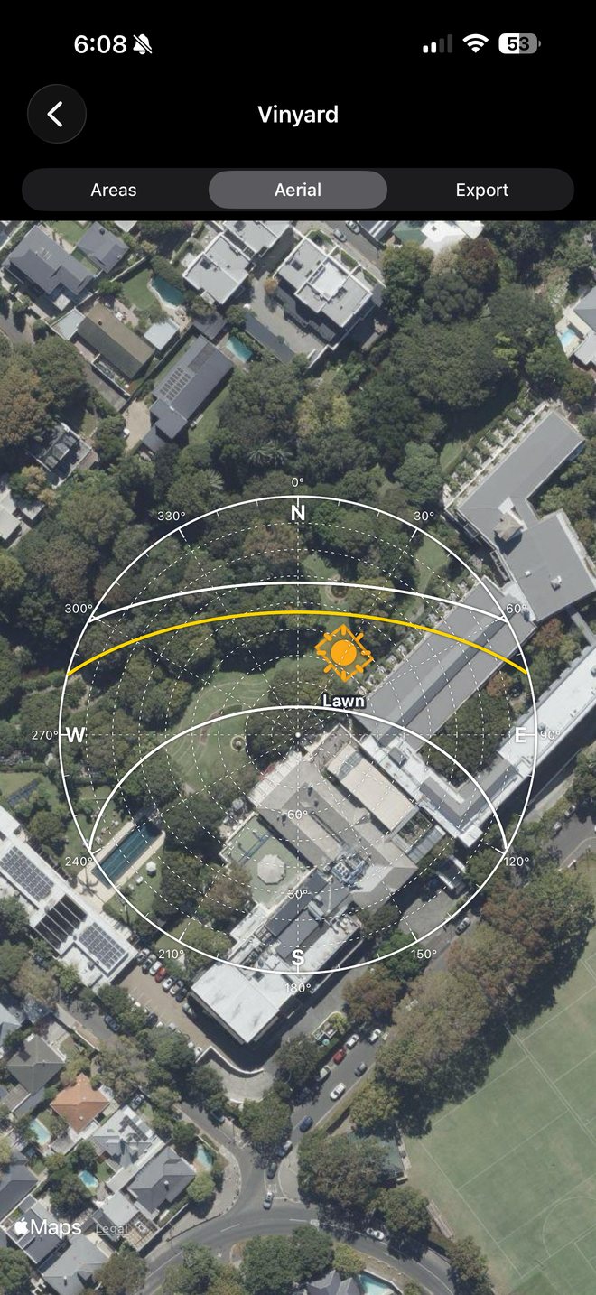
Aerial with sun path
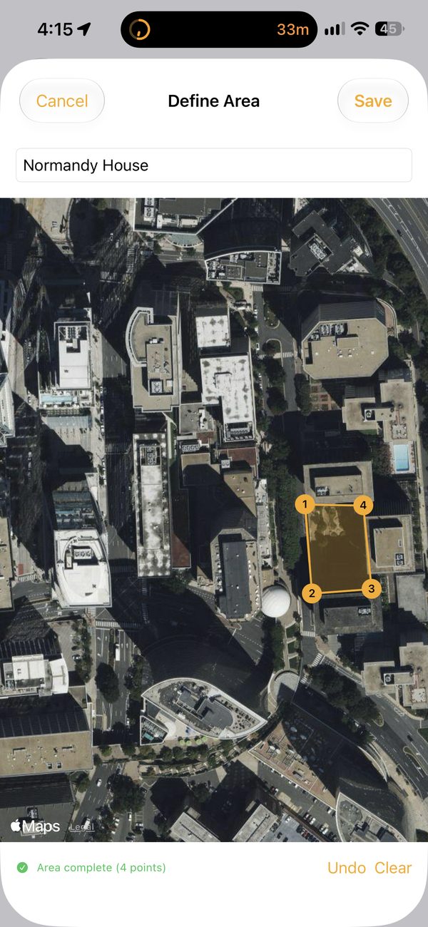
Outline each array area on satellite imagery and see the annual solar envelope drawn over it, true-north referenced.
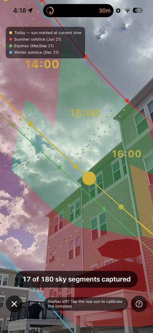
AR sun path
Point the camera at the sky and see today's path, the solstice and equinox arcs, and the live sun. Tap the real sun to calibrate the compass.
Automatic sky capture
Sweep the red band across the sky; frames capture themselves and the band turns green. No buttons, no tripod.
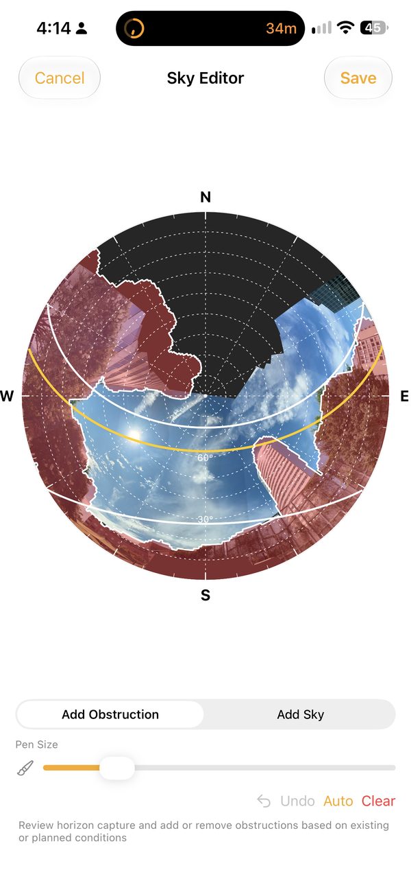
Sky editor
Review the stitched sky and mark obstructions by hand, so the report reflects exactly what you saw on site.
Shade report
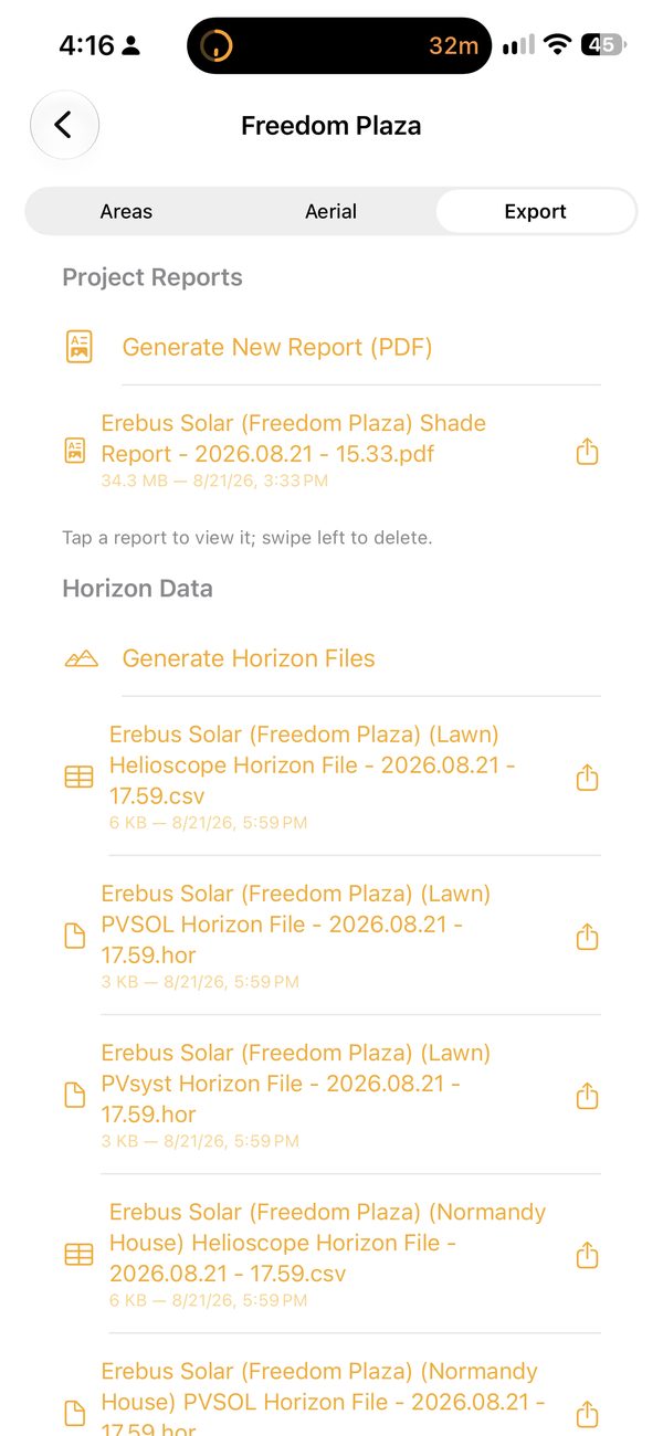
Annual solar access, TSRF and monthly charts in a PDF with your company name and logo, ready to send to the customer.
Design-software exports
Horizon files in PVsyst and PV*SOL convention plus a HelioScope CSV, generated from the same capture.
Your data stays yours
Projects, captures and reports live on your iPhone. No account, no upload, no subscription required to capture.
Designed by people who design solar systems.
Erebus Solar was designed by an electrical engineer and an architect with years of experience designing solar systems around the world.
We were fed up with the horizon-finding hardware the industry still relies on: dedicated devices that haven't been meaningfully updated in decades, are slow to use and slow to find a GPS signal, and analog tools that need paper, a pencil and a latitude template that may not exist for your site.
Erebus Solar is our answer to those frustrations. The camera, compass and sensors the job needs are already in your pocket.
Why horizon files matter
Far-field shading from trees, terrain and neighbouring buildings is one of the largest sources of error in a PV production estimate. A horizon profile measured on site lets your design software model that shading instead of guessing at it, and it's what a careful proposal, permit set or incentive application should be built on.
Erebus Solar produces horizon files that leading PV design tools such as HelioScope and PVsyst read directly, with PV*SOL accepting the same convention, so the capture you make on the roof flows straight into the simulation.
From arrival to export in one visit.
Create the project
Name it and locate it by address or your current position.
Add the areas
One per roof face or ground section, outlined on the aerial.
Capture the sky
Open Sun Path, tap the sun to calibrate, then sweep the envelope until it's all green.
Mark obstructions
Trace trees, chimneys and neighbouring buildings in the Sky Editor.
Export
Generate the shade report and horizon files, then share them straight from the phone.